
 Image 1 of 5
 Image 2 of 5
 Image 3 of 5
 Image 4 of 5
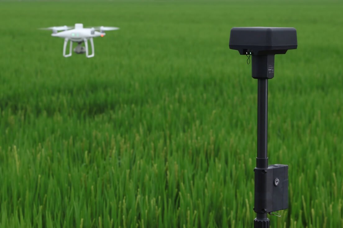 Image 5 of 5
A purpose-built, agriculture-grade drone designed for precision vegetation analysis. Featuring integrated multispectral imaging and RTK positioning, it’s tailored for professionals in agriculture, environmental monitoring, forestry, and beyond.
Equipped with one RGB camera and five monochrome multispectral sensors—Blue, Green, Red, Red Edge, and Near-Infrared—captured simultaneously on a stabilized gimbal.
Features an integrated sunlight sensor to record solar irradiance, ensuring consistent, calibrated data capture under varying light conditions.
Real-time view switching lets operators toggle between the RGB feed and NDVI overlay for instant plant health assessment in the field.
Built-in RTK module and TimeSync technology deliver centimeter-level accuracy by aligning all sensors with the flight controller and GNSS system.
Each camera is factory-calibrated, with distortion parameters recorded in image metadata for seamless processing.
Compatible with the D-RTK 2 Mobile Station or NTRIP networks for real-time corrections, while also supporting PPK post-processing for flexible workflows.
Offers up to 27 minutes of flight time per battery, ideal for efficient field surveys.
OcuSync transmission provides a live feed and remote control range up to 7 km, ensuring strong connectivity across large fields.
Takeoff weight: approximately 1.487 kg.
Service ceiling: up to 6,000 m above sea level.
Mapping efficiency: at 180 m altitude, can cover roughly 0.63 km² per flight, producing a ground sampling distance of about 9.5 cm/pixel.
CategoryHighlightsImaging SystemRGB + 5 multispectral sensors (2 MP each), global shutterLight CalibrationIntegrated sunlight sensor for consistent NDVI mappingRTK & TimeSyncCentimeter-level positioning, RTK/PPK support, precise geo-taggingFlight & Transmission~27 minutes per flight, OcuSync link up to 7 kmSpecs~1.487 kg takeoff, 6,000 m service ceiling, 0.63 km² mapping per flight